Are you looking for a high-quality labeled map of Oceania that shows the countries and dependent territories of this diverse region? If so, you have come to the right place.
About Oceania
Location of Oceania on the world map
Oceania is located between Asia and the Americas, and covers a large part of the Pacific Ocean. It is the smallest, lowest, flattest, and driest human-inhabited continent in the world. The continent spans the Eastern and Western Hemispheres and covers two major plates: the Australian Plate and the Pacific Plate. It consists of four subregions: Australasia (which includes Australia and New Zealand), Melanesia (which includes New Guinea and other islands), Micronesia (which includes Guam and other islands), and Polynesia (which includes Hawaii and other islands).
Is Oceania a continent?
There is no definitive answer to whether Oceania is a continent or not. It depends on how you define a continent and what criteria you use to classify them. Some people consider Oceania as a continent because it is a large landmass that is separated from other continents by oceans. Others regard Oceania as a region because it consists of many islands that are not part of a single continental shelf.
Countries in Oceania
According to the United Nations, there are 14 independent countries in Oceania:
- Australia
- Fiji
- Kiribati
- Marshall Islands
- Micronesia
- Nauru
- New Zealand
- Palau
- Papua New Guinea
- Samoa
- Solomon Islands
- Tonga
- Tuvalu
- Vanuatu
These countries have different cultures, languages, histories, and economies. Some of them are highly developed and globally competitive, such as Australia and New Zealand, while others are less developed and face challenges such as poverty, climate change, and health issues
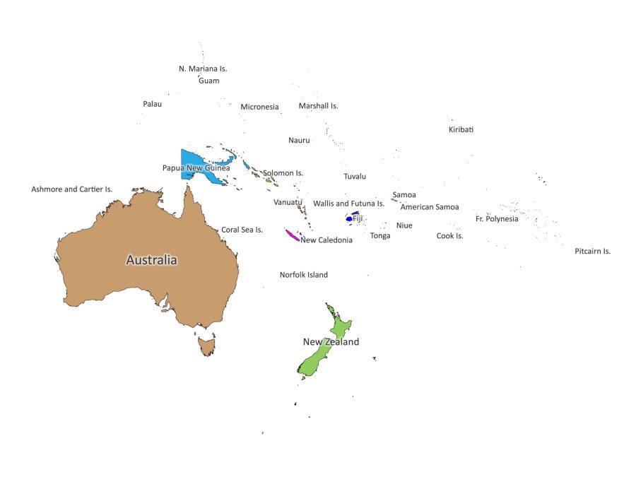
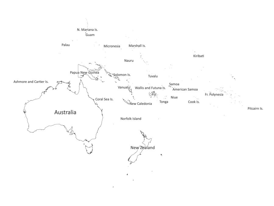
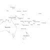
Our labeled map of Oceania shows the names and boundaries of these 14 countries in clear and legible fonts. You can use this map to learn more about the countries of Oceania.
Dependent territories in Oceania
In addition to the 14 independent countries, Oceania also has many dependent territories that are administered by other countries or have some form of association with them. These include:
- Cook Islands and Niue (associated with New Zealand)
- French Polynesia, New Caledonia, and Wallis and Futuna (overseas collectivities of France)
- Tokelau (territory of New Zealand)
- Pitcairn Islands (British overseas territory)
- American Samoa, Baker Island, Guam, Howland Island, Jarvis Island, Johnston Atoll, Kingman Reef, Midway Atoll, Northern Mariana Islands, Palmyra Atoll, and Wake Island (territories or possessions of the United States)
- Ashmore and Cartier Islands, Coral Sea Islands, and Norfolk Island (external territories of Australia)
- Easter Island (special territory of Chile)
- Maluku (Aru Islands), Central Papua Highland Papua Papua South Papua Southwest Papua West Papua (provinces of Indonesia)
- Hawaii (state of the United States) – excluded from map
Our labeled map of Oceania also shows the names and boundaries of these dependent territories. You can use this map to explore the diversity and complexity of Oceania’s political geography.
Is the Labeled map of Oceania editable?
Yes, our labeled map of Oceania is editable. You can customize it according to your needs and preferences. You can change the colors, fonts, sizes, shapes, and labels of the map elements. You can also add or remove any features that you want.
Our labeled map of Oceania is available in five different file formats: PDF, JPG, PNG, SVG, and AI. All these formats are bundled in a zip file that you can download instantly after purchase. You can use any software that supports these formats to edit the map but we highly recommend using the SVG or AI file to edit.
PDF: Portable Document Format is a widely used format that preserves the layout and quality of the map. You can use Adobe Acrobat Reader or any other PDF viewer to open and print the map.
JPG: Joint Photographic Experts Group is a common image format that compresses the file size without losing much detail. You can use any image viewer or editor to open and edit the map.
PNG: Portable Network Graphics is a format for images that supports transparency and lossless compression. You can use any image viewer or editor to open and edit the map.
SVG: Scalable Vector Graphics is a format for images that use vector anchor points instead of pixels. This means that you can resize the map without losing quality or clarity. You can use any vector graphics editor such as Adobe Illustrator or Inkscape to open and edit the map.
AI: Adobe Illustrator is a format for vector graphics that is compatible with Adobe Illustrator software. You can use Adobe Illustrator or any other software that supports AI files to open and edit the map.
Why buy our Labeled map of Oceania?
Our labeled map of Oceania is a great product for anyone who wants to learn more about Oceania or use it for various purposes such as education, or personal interest. Here are some reasons why you should buy our labeled map of Oceania:
- It is accurate and up-to-date. We have used reliable sources and data to create our labeled map of Oceania. We have also checked and verified every detail and label on the map.
- It is comprehensive and detailed. We have included all the countries and dependent territories of Oceania on our labeled map of Oceania. We have also shown their names and boundaries clearly and legibly.
- It is customizable and editable. You can modify our labeled map of Oceania according to your needs and preferences. You can change the colors, fonts, sizes, shapes, and labels of the map elements. You can also add any features that you want.
- It is available in multiple file formats. You can choose from five different file formats: PDF, JPG, PNG, SVG, and AI. All these formats are bundled in a zip file that you can download instantly after purchase.
- It is printable and high-quality. You can print our labeled map of Oceania on any paper size and quality that you prefer. You can also choose between black and white and colored versions of the map. Our labeled map of Oceania has a high resolution of 300 dpi (dots per inch), which ensures a clear and sharp printout.
Reviews
There are no reviews yet.